

How Tsunami Warning Systems Work: From Earthquake Detection to Public Alerts
A complete guide to how global tsunami warning systems detect earthquakes, assess tsunami risk, and issue alerts — from seismic networks and DART buoys to the agencies and technology that protect coastal communities worldwide.
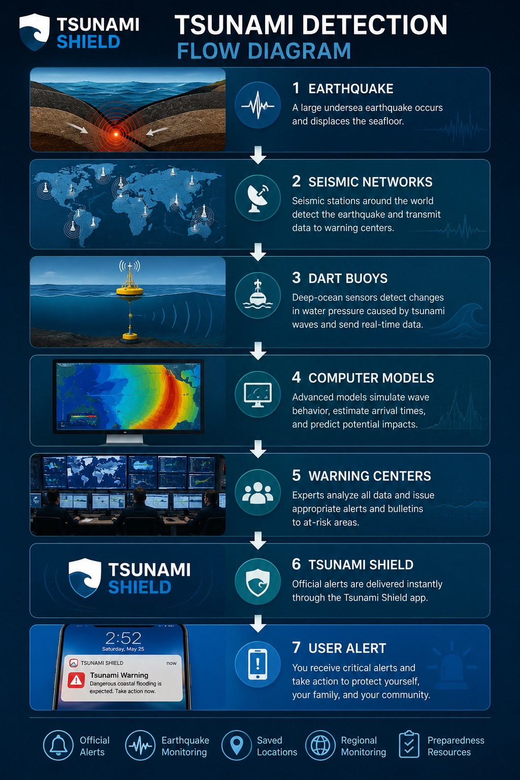
Modern tsunami warning systems are among the most sophisticated natural hazard monitoring networks in the world. Every day, scientists and monitoring agencies track thousands of earthquakes, ocean conditions, and coastal observations to determine whether a tsunami threat exists.
When a major undersea earthquake occurs, warning centres must quickly answer critical questions: Could a tsunami form? Which coastlines might be affected? How much time is available? What warnings should be issued?
Understanding how tsunami warning systems work helps explain why official alerts are such an important part of coastal preparedness.
Why Tsunami Warning Systems Exist
Tsunamis can travel across entire oceans at speeds exceeding 800 km/h (500 mph). In some situations, local coastal communities may only have minutes to react — see our guide on how much warning time you get before a tsunami arrives.
The goal of tsunami warning systems is simple: detect potential threats quickly, analyse available data, provide accurate warnings, and give people enough time to take protective action.
Modern systems combine earthquake monitoring, ocean sensors, satellite communications, and advanced computer modelling.
Step 1: Detecting an Earthquake
Most tsunamis begin with a large undersea earthquake. When an earthquake occurs, seismic monitoring stations around the world immediately detect ground movement. Scientists analyse the earthquake's location, depth, magnitude, and fault movement.
Certain earthquakes are more likely to generate tsunamis than others. Generally, earthquakes occurring beneath the ocean and larger than magnitude 7.0 receive immediate attention from warning centres.
Step 2: Initial Tsunami Assessment
Once an earthquake is detected, experts determine whether conditions are capable of generating a tsunami. Key factors include magnitude (larger earthquakes have greater potential to displace ocean water), depth (shallow earthquakes are more likely to generate tsunamis), location (earthquakes beneath the ocean present higher tsunami risk), and type of fault movement (vertical movement of the seafloor is often required to generate significant tsunamis).
At this stage, warning centres may issue information statements, watches, advisories, or warnings depending on the available data.
Step 3: Deep-Ocean Monitoring
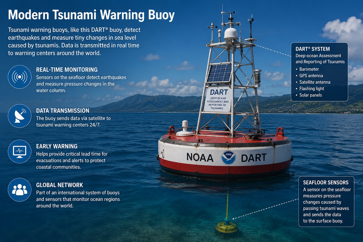
A key component of modern tsunami detection is the Deep-ocean Assessment and Reporting of Tsunamis system, commonly known as DART. DART stations consist of a seafloor pressure sensor, a surface buoy, and satellite communications equipment.
The seafloor sensor detects tiny changes in water pressure caused by passing tsunami waves. This information is transmitted to warning centres in near real time. DART systems help confirm whether a tsunami has actually formed.
Step 4: Computer Modelling
Once an event is detected, advanced computer models simulate how tsunami waves may travel across the ocean. These models estimate arrival times, wave heights, affected coastlines, and flood potential.
Because every coastline is different, local impacts can vary significantly. A small wave in one location may become a dangerous surge in another.
Step 5: Coastal Monitoring
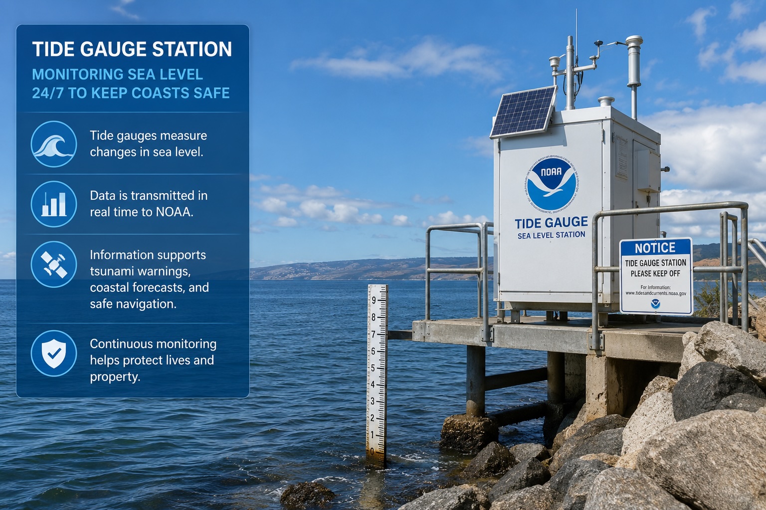
Warning centres also use tide gauges installed along coastlines and in harbours to monitor sea-level changes and help confirm actual tsunami activity. Many countries maintain additional coastal observation networks to verify conditions near shore.
Step 6: Issuing Public Alerts
Once sufficient information is available, warning agencies issue official alerts. Common alert levels include — learn more about the difference between a watch, advisory, and warning:
Information Statement — no immediate threat exists.
Tsunami Watch — a tsunami may be possible. People should remain alert and monitor updates.
Tsunami Advisory — strong currents and hazardous coastal conditions are expected.
Tsunami Warning — dangerous flooding and significant coastal impacts are expected or occurring. Immediate action may be required.
Who Issues Tsunami Warnings?
Several organisations operate tsunami monitoring and warning systems — see the full list of official data sources used by Tsunami Shield. NOAA is responsible for tsunami warnings across much of the United States and Pacific regions. GeoNet monitors earthquakes and tsunami threats affecting New Zealand. GDACS provides international disaster coordination and event monitoring. Many countries also maintain their own national tsunami monitoring and emergency management organisations.
Why Warnings Sometimes Change
As additional information becomes available, warning levels may be upgraded, downgraded, or cancelled. This is normal — for common questions about how this works, see our tsunami alerts FAQ. Scientists continually refine forecasts using seismic data, DART observations, tide gauge measurements, and computer modelling. The goal is always to provide the most accurate information possible.
The Importance of Official Alerts
Social media and unofficial reports can spread rapidly during emergencies. However, official warning agencies remain the most reliable source of information during tsunami events. Official alerts are based on scientific analysis, verified sensor data, and operational monitoring systems.
Following official guidance can help individuals and communities make informed decisions during rapidly evolving situations.
How Tsunami Shield Supports Preparedness
Tsunami Shield helps users stay informed by monitoring official tsunami and earthquake data sources and delivering alerts directly to their mobile devices. Features include critical alert notifications, earthquake monitoring, saved locations, regional monitoring, and emergency preparedness resources.
The goal is simple: help people stay aware, prepared, and informed when coastal hazards occur.
Official Alerts on Your Device
Tsunami Shield monitors official tsunami warning agencies and delivers alerts directly to your phone — for your home, saved locations, and every destination you travel to.
Final Thoughts
Modern tsunami warning systems combine science, technology, and international cooperation to help protect coastal communities around the world. From earthquake detection and deep-ocean sensors to computer modelling and public alerts, multiple layers of monitoring work together to identify potential threats and provide timely warnings.
Understanding how these systems operate can help individuals better appreciate the importance of preparedness and the role official alerts play in coastal safety.
Frequently Asked Questions
How do tsunami warning systems detect a tsunami?
Tsunami warning systems use a combination of seismic networks to detect underwater earthquakes, DART deep-ocean buoys to measure pressure changes caused by tsunami waves, and coastal tide gauges to confirm sea-level activity near shore. Together these systems allow scientists to detect, assess, and issue warnings within minutes of a major event.
How quickly can tsunami warnings be issued?
Modern systems can issue initial warnings within minutes of a major earthquake being detected. Seismic networks identify events almost immediately, and DART buoy data helps confirm whether a tsunami has formed. The exact timeline depends on the earthquake's location, magnitude, and proximity to populated coastlines.
What is a DART buoy?
DART stands for Deep-ocean Assessment and Reporting of Tsunamis. DART buoys are ocean monitoring stations consisting of a seafloor pressure sensor and a surface buoy connected by acoustic communications. The seafloor sensor detects tiny changes in water pressure caused by passing tsunami waves and transmits data to warning centres in near real time via satellite.
Why do tsunami warning levels sometimes change?
Warning centres continuously update their assessments as new data becomes available from seismic networks, DART buoys, tide gauges, and computer models. A warning may be upgraded if conditions are more severe than initially estimated, or downgraded and cancelled if monitoring shows that significant tsunami waves did not form. Updating warnings is a normal and important part of the scientific process.
Read Next
Continue exploring related topics


